
Author Archives: Kelly Karst
Carousels Group Update Week 14
We were able to make some practical, and sometimes exciting progress this week!
Leonard worked on some aesthetic details on the website including adding some jazzy imagery, fixing margins, and making page layouts function on both desktop and mobile devices.
Julissa has been posting away on Instagram and has an ambitious to post (almost) daily alternating between posts and stories in the countdown to our project launch. With Leonard’s help, Julissa began mentioning carousels in posts and both Prospect Park and Bryant Park took notice! We also started to to get on the radar of the GC Digital Humanities and Data Vis programs Instagram pages.
We’ve all been working on our individual blog posts for each carousel and are almost ready to link them to our map as a “more information” sort of thing. Speaking of the map, we did notice a display quirk with the layers and Carla is going to ask a GC Fellow for some advice. Carla suspects it may have something to do with the size of the map pin. Carla has also started to work on analysis of what we learned from the map, with an ambitious plan to maybe incorporate a visualization of some sort (but no pressure!).
Carla has also agreed to be our presenter, and I (Kelly) will be the backup. She’s going to do a great job representing our project- which just has a few finishing touches before showtime!
Group Update Week 13
We’ve made good progress, and learned some things since our last update!
Leonard reached out to decided upon contacts mostly in the tourism/parenting sphere, and got responses from everyone BUT they either said they would not post our project OR wanted a minimum of $500 to do so. Leonard is now brainstorming how to leverage the social media influencer world to see if our project can get some traction in the public sphere that way.
Julissa received our promotional bookmarks and has created a solid social media schedule of her tracker. She has started posting has plans to create “buzz” around our project launch with a countdown+fun facts. She has a goal of 3 posts per week up to the project launch. Julissa and Leonard are in conversation on how to reach out to influencers via Instagram, and considering tagging carousels in our posts for a hopeful re-post!
Carla made great strides with the map. All pins are included and the map is successfully embedded on our site with help from The Center for Teaching and Learning staff. We modified the StoryMap and the embed so it “fit” more nicely on the page. Carla has also been hard at work modifying our project presentation slides.
I made some aesthetic updates to the website, mainly solidifying our header’s logo/color scheme, and a little bit of page formatting. Leonard is going to use his amazing WordPress/CSS skills to further enhances the aesthetic, and to make sure things look good on desktops, tablets, and phones.
We asked permission to use AI to help with our tagline- this is the sort of thing it can be really helpful for. We decided on a melange of responses to land on:
Round and Round: NYC Carousels and the Stories They Spin
Carousels Week 11
For the most part, we are meeting our milestones, and then some!
Based on our agreed upon template for carousel blog posts last week, I was able to create posts for some of our carousels, to which group members will create their own for their corresponding carousels. Carla has been keeping up with our map and worked out a kink with how to include a featured image on the pin. Leonard commenced outreach and got an excited (but $$$) reply from TimeOut NYC and a more subdued, but promising reply from Brooklyn Bridge Parents. Julissa put up our first post on Instagram and has been working on a social media schedule. She also created a lovely promotional bookmark with an order in (or about to go in!) to be ready to hand out at our May 13 presentation.
Some setbacks that have been mentioned before has been the difficulty visiting some carousels to take original photos/videos due to weather or them not being open yet for the season! To make up for this, we have strategized a way to find, incorporate, and give credit to creative common license photos- mostly found via Google Image Search -> Flickr.
We continue to have embedding issues on CUNY’s instance of WordPress- but now it’s not just the map! Turns out if a video isn’t YouTube or Vimeo- it ain’t embedding. We are also having a strange glitch with our logo showing up on our header on mobile, but not on PCs. Nicole was kind enough to suggest a contact (Laurie H.) at the Teaching and Learning Center at the GC. Laurie provides workshops and support for CUNY Academic Commons to faculty, but Nicole thought she may be willing to help. We have also put in a ticket to CUNY Academic Commons- so we’ll see! We know the things work on other WordPress instances- so a mystery abounds!
Most of us will be around for Spring Break and plan on putting some asynchronous individual work in. I (Kelly) will be out from Thursday-Tuesday (but in class!)
Carousels Group Update Week 10
We are continuing to go ahead on a good clip with our project, but aren’t immune from some roadblocks!
What’s going well?
Website: Added our fonts and colors to the website, and have added all of our profiles to the about page. We decided on a template for our carousel blog posts, so Kelly will get started on creating an example post for us each to follow when we post about the carousels we’re assigned to. Leonard is working on using CSS to add the logo to the header of our page.
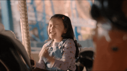
Visiting Carousels: We’ve had great weather, and some carousel openings, so we’ve all been able to visit at least one, and all have plans to visit more. Kelly was able to visit Prospect Park, and Julissa visited the Sea Glass carousel, so we have plenty of original photos/videos for those carousels to use for our site and social media.
Outreach & Social Media: Leonard has created communication templates and is actively identifying and vetting potential contacts with hopes to initiate contact soon. Julissa is diving into our social media presence, brainstorming post ideas around reviews, fun facts, team introductions, and project promotion on Instagram.
Where are we facing challenges?
- Carousel Access: Unfortunately, some of our assigned carousels have been either closed or inaccessible for visits. We may need to rely on creative commons pictures for these locations if all else fails.
- Map Embedding: Carla has successfully generated the map embed code, and it works on standard WordPress instances. However, we’re encountering issues embedding it correctly on the CUNY Commons platform. Carla is going to reach out to our CUNY Commons Mapping Group to see if we can get any tips.
Tasks for the Upcoming Week (Leading up to the presentation):
Leonard:
- Create a logo for the website header using CSS.
- Continue outreach efforts.
Julissa:
- Draft and schedule social media posts.
- Create Instagram “highlights” for each borough showcasing our visited carousels.
- Start draft for info-graphic handout
- “Jazz up” presentation slides with graphic design razzamatazz
Carla:
- Prepare the project presentation for next class for Julissa to jazz up.
- Goal: Have all carousels have a pin on the map (even if represented by a placeholder image for now).
- Reach out to the Map group on CUNY Commons for help with embedding the map on our specific platform.
Kelly:
- Finalize the blog template structure and complete blog posts for assigned carousels
All Team Members:
- Visit more assigned carousels to gather photos and videos whenever possible.
- Research “fun facts” about our assigned carousels for possible social media posts
Carousels Group Project Update March 26
We believe we’re going at a good pace, and have appreciated the time in class to discuss the project, while getting a lot done independently.
In terms of milestones, we have good bones to our website, the map is coming along nicely, we agreed upon a visual identity system (logo, fonts, colors), have started an Instagram page, and have started drafting communication templates for our outreach efforts.
We haven’t visited as many carousels as we anticipated in our timeline, but have visited some. We’re not too worried about it as many carousels are starting to open (literally this weekend), and others have been postponed due to cold/wet/windy weather. We all have plans to visit more shortly.
We also had a domain mapping issue with the website, but it seems to be resolved. We were unable to edit the website for about a week, but we were a little ahead of schedule with that, so no worries.
The map is going well with a combination of ArcGIS Storymaps, and possibly ArcGIS itself (if needed). Carla has been in regular contact with a Digital Fellow to troubleshoot. We’re currently trying to figure out a better way to embed images of the carousels within the metadata.
Since our visual identity system is ready, we can start embedding it more to the website and begin planning for handouts and future posts for social media. We are also going to gather a list of points of interest to reach out to once our outreach templates are complete.
Carousels of NYC website
We’re still in the middle of domain hosting woes- but should be up soon.
If you click right now (ie: March 19th, 2025) it may have an error, BUT
Our CUNY Academic Commons site is: https://carouselsnyc.commons.gc.cuny.edu/
which is the redirect from our domain: https://www.carouselsofnyc.com/
Domain Mapping
For my personal blog post this week, I thought I would focus on domain mapping on the Commons in case this information proves useful to others in this class, or future iterations of this class.
We decided to use CUNY Academic Commons for our website since WordPress is a platform we’re familiar with and find that it will be an appropriate tool to showcase our project. It’s great that we have access to this resource with our CUNY credentials.
But, the Academic Commons URL may not be the catchiest, user-friendly, or most discoverable way to find a site that may potentially have broad appeal. On the advice of Dr. Maney, we decided to purchase the domain http://www.carouselsofnyc.com/
But how to map it to our CUNY Academic Commons page? Well, if you’re viewing this within moment of posting this, you may find that there’s errors/glitches to viewing our site. We are currently in the process of working the with the Commons Team to troubleshoot, but in any case….
We thought we might be able to do this domain mapping on our own, perhaps through the dashboard of out site, with a WordPress plugin, or through the domain registrar. BUT, then we found these instructions:
https://help.commons.gc.cuny.edu/domain-mapping-commons/
Turns out- we need to request this service directly through the CUNY Academic Commons support team. I followed directions to assign our domain a CNAME record in the domain registrar and took a screenshot showing those settings. I then sent an email to [email protected] with that screenshot and our website information to request the mapping. I was very quickly re-routed to a specific support team member who reached out to the parent company of CUNY Academic Commons to connect the domains. Unfortunately, this initial mapping either went to a blocked page (if on a CUNY campus) or the CUNY Academic Commons sign in page.
This issue has been somewhat resolved, but there continues to be issues- it seems that it may have something to do with the original mapping including www. on the domain registrar where there may need to be one that does not with a focus on the https://.
Although we are the process of troubleshooting, I hope that this is helpful for those starting the process of domain mapping via CUNY Academic Commons.
Bio & Contribution Statement
Kelly Karst (she/her) is the User Experience and Emerging Technology Librarian at CUNY Brooklyn College and a current M.A. student in Digital Humanities program at the CUNY Graduate Center. With a diverse background in psychology, art history, and film studies, she delves into various topics reflecting her experiences and academic pursuits. With roots in Panamá, Kelly’s personal research interests are in Latin American and Caribbean studies, as well as exploring her toddler’s hometown: NYC! Kelly was the Project Manager for this project and assisted with website development.
Carousels of NYC Project Work Plan
Carousels of NYC Project Work Plan
| Week | Tasks |
| Week 3: Feb. 10-16 | Planning and Research:
Establish group norms (all) Revise and submit project proposal (Kelly + all) Create project management tracker and input tasks (Carla + all) |
| Week 4: Feb. 17-23 | Design:
Establish website presence (Leonard) Planning: Begin drafting Project Plan (Kelly + all) |
| Week 5: Feb. 24- Mar. 2 | Planning:
Finalize and Submit Project Plan by March 3 (Kelly + all) Discuss (and finalize) data collection categories for carousels (for map vs. website) by 2/28 (all) Discuss data management plan (Carla + all) Technical Development: Attend ARCGIS Storymap workshop 2/26 (Carla, Kelly, Julissa) Consult with Digital Fellow on Carousel shapefile or other alternatives by 2/26 (Carla) Content Development: Create preliminary layers on ARCGIS by Feb. 28 (Carla) Collect data from Bryant Park carousel to test data collection categories and provide preliminary media assets. (Leonard) Design: Create canva account; create social media tracker (Julissa) |
| Week 6: Mar. 3-9 | Planning:
Create first draft of data management plan by March 3 to discuss and finalize in class with team on March 4 (Carla) Submit Data Management Plan by March 5 (Carla) Collect ideas for outreach plan (Leonard) Content Development: Personal bios and contribution statements by March 3 (All) Research and Rough Clean demographic data by March 3 (Carla) Watch Youtube videos and read other online resources to learn how to layer collected carousel data by Mar. 4 (Carla) Layer Bryant Park data & picture into Map (Carla) Confirm what location code is needed for carousels by Mar. 4 (Carla) Visit and collects data for Queens carousel sites by March 7 Design: Provide logo options, develop social media plans (Julissa) |
| Week 7: Mar. 10-16 | Planning:
Present rough draft of Outreach plan to the rest of the group. After the group meeting, finalize it. (Leonard) Content Development: Provide media for Manhattan carousels to use on social media/website (Leonard) Layer Manhattan/Queens sites data into Map (Carla) Clean Demographic Data and prepare for layering (Carla) Design: Create instagram account, develop graphic design for the website (Julissa) Incorporate preliminary graphic design guidelines into map (Carla) |
| Week 8: Mar. 17-23 | Planning:
Presentation on collaboration March 18 (Kelly) Technical Development Presentation on consultation(s) March 18 (Carla) Read and watch online resources to learn how to code in Map to website (Carla) Content Development: Website draft complete by March 19 (Kelly) Check progress on data collection for remaining sites, primarily Brooklyn (Carla) Layer in neighborhood demographic data (Carla) Design: Presentation on Social Media Plan March 18 (Julissa) Outreach: Presentation on Outreach Plan March 18 (Leonard) |
| Week 9: Mar. 24-30 | Content Development:
Insert 2-3 Manhattan/Staten Island/Bronx site data (Carla) Design: Discuss logo design plans (if not done so already) (Julissa + all) Incorporate graphic design plan into website aesthetic (Kelly and Leonard) Begin creating social media draft posts (Julissa) Evaluation: Check Map features and layering, test site for user experience (Carla) |
| Week 10: Mar. 31- Apr. 6 | Content Development:
Insert 2-3 remaining site data (Carla) Design: Continue creating social media draft posts (Julissa) Draft project presentation slidedeck (Julissa) Continue refining website and adding carousel posts (Kelly+Leonard+all) |
| Week 11: Apr. 7-13 | Project Presentation for class April 8
Evaluation: Continue Map maintenance and end user testing, focus on mobile devices (Carla) |
| Week 12: Apr. 14-20 | SPRING BREAK
Evaluation: Check data in all google forms for discrepancies to ensure accuracy and uniformity (Carla) |
| Week 13: Apr. 21-27 | Content Development:
Check on progress of carousel posts (Kelly + all) Design: Begin creation of mobile version of website (Kelly + Leonard) Begin to post on social media (Julissa) |
| Week 14: Apr. 28- May 4 | Final deadline to visit carousels and submit posts
Planning: Develop and practice “dress rehearsal” (All) Evaluation: Test website/map on various devices and browsers while considering different user roles: Families, tourists, city parks/planners, carousel enthusiasts (All) |
| Week 15: May 5-11 | Project launch dress rehearsal May 6
Planning: Take in feedback to revise presentation for public project launch (All) |
| Week 16: May 12-18 | Public project launch at the GC Digital Showcase May 13 |
| Week 17: May 19-25 | Post final group project reports as public posts to Commons blog by May 20
Email individual reflection papers to the instructor by May 20 |